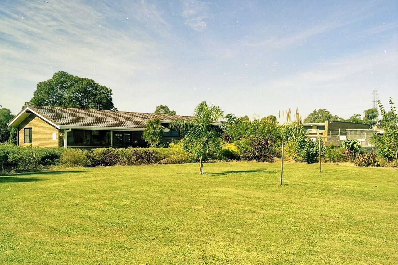
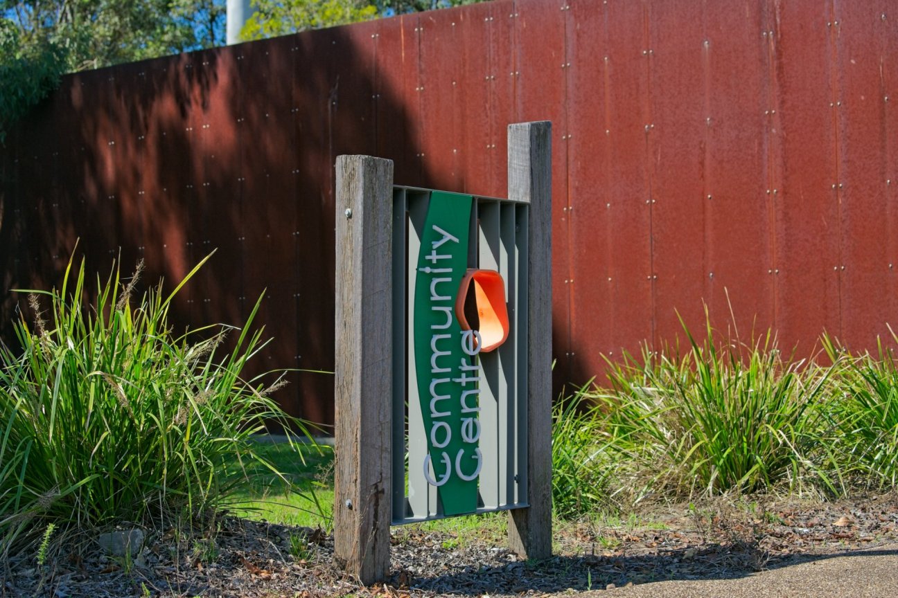
Fitzgibbon Community Centre is at the heart of Fitzgibbon and offers space for activities and programs for everyone.
Fitzgibbon is a northern suburb of Brisbane, Queensland, located about 16 km from the city centre and about 6 km from the northern shores of Moreton Bay. Named after Abraham Fitzgibbon, a former Queensland Railways Chief Engineer, it offers modern housing, numerous parks, playgrounds and bushland. Despite substantial housing development in recent decades, there is still history underfoot—if you know where to look.
If you are curious about this quiet and low-profile suburb, here is your chance to learn more of its sometimes surprising past.
The suburb of Fitzgibbon is just 50 years old. Originally a wild, open and slightly mysterious place that people drove past without a glance, in recent decades it has transformed into a thoughtfully designed community surrounded by bushland. Author Judy Wakabayashi has captured the history of Fitzgibbon and its recent transformation in her excellent book Butterflies and Bandicoots: On Becoming Fitzgibbon. Following the book release, a conversation took place between Keith Heinrich and Judy Wakabayashi about making significant locations and history accessible. And the Fitzgibbon Trail project was born.
The Fitzgibbon Trail is yours to enjoy. We hope it helps unlock some of the locations, their history and significance in one of Brisbane’s smallest suburbs.
Much of the information here has been sourced from Judy Wakabayashi’s detailed and authoritative research, Butterflies and Bandicoots: On Becoming Fitzgibbon. If what you have seen here has tickled your curiosity, then definitely take a look at this book.


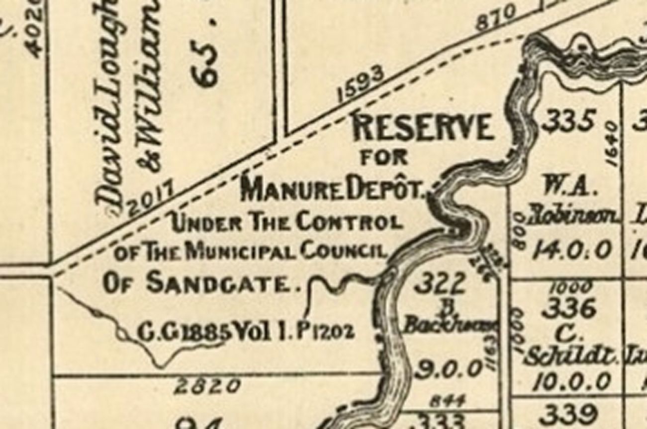

In 1888, 54 acres in this corner of Fitzgibbon was reserved for the sanitary needs of the citizens of Sandgate. At this location is where the road leading into the site was, hence “Depot Road”. Today there is an interpretive sign on the bikepath overlooking what has been preserved of the original road.

One early local business was a brickworks located just outside the Cabbage Tree Creek boundary of what is now Fitzgibbon.
On 11 May 1885 Leopold Fiedler from Prussia became the new owner of Portion 345, and he set up a brickworks with his son Francis. Bricks from Fiedler’s brickworks are thought to have been used in building the replacement Sandgate Post Office, which opened in May 1887.
In early February 1893 a cyclone dumped 1,026 millimetres of rain at the Brisbane Regional Office, the highest monthly total recorded for Brisbane. The resulting flood was followed by heavy rains and two more cyclones by mid-February. These floods, the worst since free settlement began, submerged 128 hectares in north Brisbane, killed thirty-five people, and had a devastating effect on the economy. They also destroyed the Fiedler brickworks, bringing an end to this local business.
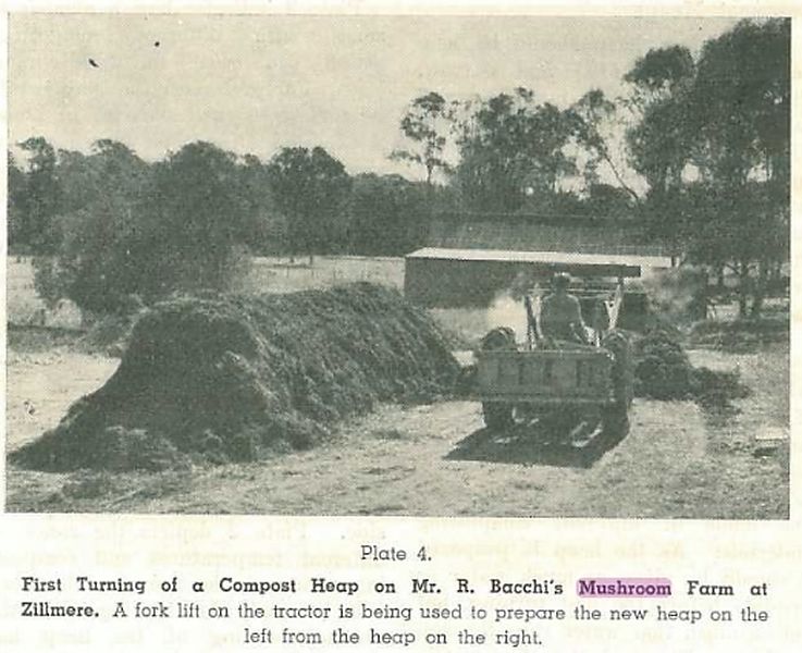
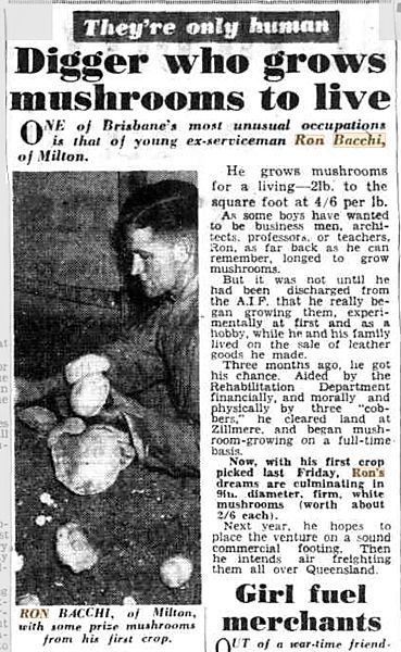
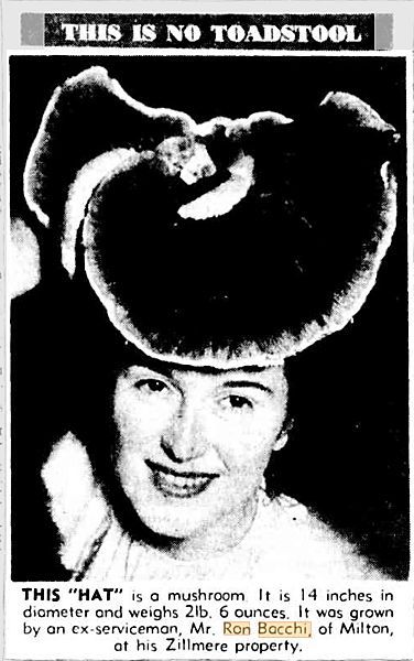
From early 1949 Ronald (Ron) Anthony Bacchi (born in Cloncurry in 1921; died in 2002) of Milton operated a large mushroom farm on this property at the corner of Roghan and Handford Roads. Bacchi was an ex-Australian Imperial Force serviceman, and the farm was established with financial aid from the Rehabilitation Department.1
The Bacchi family was still living on Roghan Road in 1958, but by 1963 they were listed in the electoral roll as living on Handford Road. When the Roghan Road–Handford Road intersection was built, the Bacchi house was resumed, and units now stand where the farm used to be.
Long-timers in this area still remember the smell emanating from the farm.
- Wakabayashi 2025: 82 ↩︎
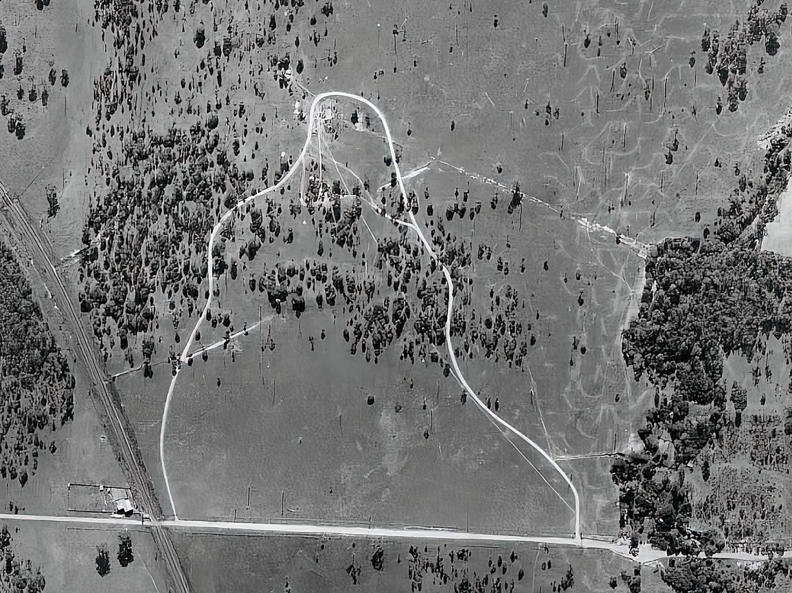

“Given the vital importance of radio communications intelligence during the Second World War, there was a need to construct a remote receiving station (RSS) “some distance from the city to permit the reception of signals which otherwise could not be received owing to the high electrical noise level existing in the city of Brisbane”—i.e. weak signals from aircraft and distant transmitting stations. The site also had to be large enough to accommodate receiver aerials. Local paddocks between Beams Road and Roghan Road fit these criteria, so in July 1942 approval was given for the Air Force to take over Resubdivisions 2 and 3 of Subdivision 1 of Portion 6.”1
This RRS was located at 441 Beams Road, Zillmere as this area was then known. The apex of the loop track was just slightly south of where today Silkyoak Circuit and Primrose Street intersect. The bunker would have been in the front yards of 23 and 25 Silky Oak Circuit. Nothing of this structure remains.
- Wakabayashi 2025: 82 ↩︎

D. M. Christie & Sons’ sawmill was located from Roghan Road back to the general area around what is now Oxford Place. It was in operation by 10 November 1952 or earlier, as evidenced by a Christie’s advertisement in The Brisbane Telegraph that day.
On 20 October 1955 Harold Thomas Arthur Stickler (born in Bristol in 1907; died in 1991) purchased the land on which the sawmill was located. His family had arrived in Brisbane from England in 1909. Harold worked as a carpenter before taking over the sawmill. The 1959 electoral roll lists him as a builder residing on Roghan Road, and he owned the sawmill until around 1963 or later. His wife was Alice Margaret Stickler (married in 1945), and they had seven children, at least some of whom attended Zillmere North State School.1
Subdivisions 1 and 2 of Portion 94 were later leased to Oregon Sales Pty. Ltd., which works in the timber and forestry industry, for five years from 1 July 1974 and then a further five years from 1 July 1979. On 24 March 1982 this company became the owner of these two subdivisions.
Today this location can be identified by the row of casuarina trees along Roghan Road between the Hidden World playground and Cambridge Crescent.
- Wakabayashi 2025: 104 ↩︎

Back in 1886 the Moreton Mail carried an article that proposed situating a public pound at the Cabbage Tree Creek manure depot (Portion 284),
… which place is already fenced in, having a caretaker’s house, and supplied with a creek of permanent water. The only expense entailed, would be the construction of a stockyard. The Corporation contractor might well be appointed pound-keeper, he to collect his own fees, and to pay the Corporation a royalty on each animal passed through the yard.
Nothing much seems to have happened until construction of a new animal pound and dog refuge commenced in mid-1977. Occupying some fourteen acres, this included two dwellings for the pound-keeper and the impounding stockman and their families. The Warra Municipal Pound and Dog Refuge opened at 521 Telegraph Road on 15 May 1978 at a cost of $300,000. Warra is an Aboriginal name for the Sandgate area and reportedly means “flat expanse of open water”.1
“By November 2015 or earlier its name had changed to Warra Rehoming Centre, and it was actively advertising dogs and cats that needed rehoming.”2
Today there are two animal rehoming centres run by staff from Animal Welfare League Queensland (AWLQ). Staff at the animal rehoming centres make every effort to identify the owners of lost animals and reunite them with one another, and they rehome any unclaimed animals that are healthy and sociable.
One of three surviving historic locations and inextricably linked to Fitzgibbon’s past and present, the former Somerset Equestrian Centre facility was a busy place back in the day. It had a large track in the area where there are now houses, in addition to the stables and other facilities that remain on the site today.
Both 12 and 42a Desert Willow Way were part of the equestrian centre. An article about the property at 12 Desert Willow Way states that “in 1979 just one house stood in the district”. The house, then owned by Cholm Vidgen, was originally built in Cannon Hill during the 1930s. It remained there until Mr Vidgen relocated it in 1979 to a 67-acre property in Fitzgibbon. The property began its new life as a homestead for an equestrian centre, with visitor’s accommodation next door.
In 1986 the Equestrian Centre hosted the Queensland Derby over three weekends. This involved a mixture of events and jumpers from around the state and overseas—and an expected crowd of over 15,000 people. While it was suggested that the Equestrian Centre could become a place with enduring regional focus, this never eventuated.
Cholm Vidgen had a strong interest in property development. In 1990 he was involved, through EVE Developments, in the Greenfields Estate that arose out of the Fitzgibbon Development Plan introduced by the Liberal Council under Lord Mayor Sallyanne Atkinson. The area where the large track used to be and across Desert Willow Way to Tulip Close was developed into housing as “The Greenfields Estate”, leaving no trace of the track, stables or any part of the equestrian activity that was conducted there for many years.
Somerset Equestrian Centre was still operating at least until April 2012, when a show jumping event was held. On 21 September 2012, 42A Desert Willow Way was sold to horse trainer Patrick Brian Timothy Rosel and Vanessa Jane Rosel. When the Rosels listed the property for sale in September 2017, it was “Registered and licensed for 9 thoroughbreds. 450sqm Arena, spilling stables. 3,600sqm Approx. paddock space.”
Today both properties are private residences, with the original buildings at the Somerset Equestrian Centre and 12 Desert Willow Way the only reminder of the past.


Somerset Equestrian Centre images provided by Keith Heinrich with kind permission from Hudson Dale.
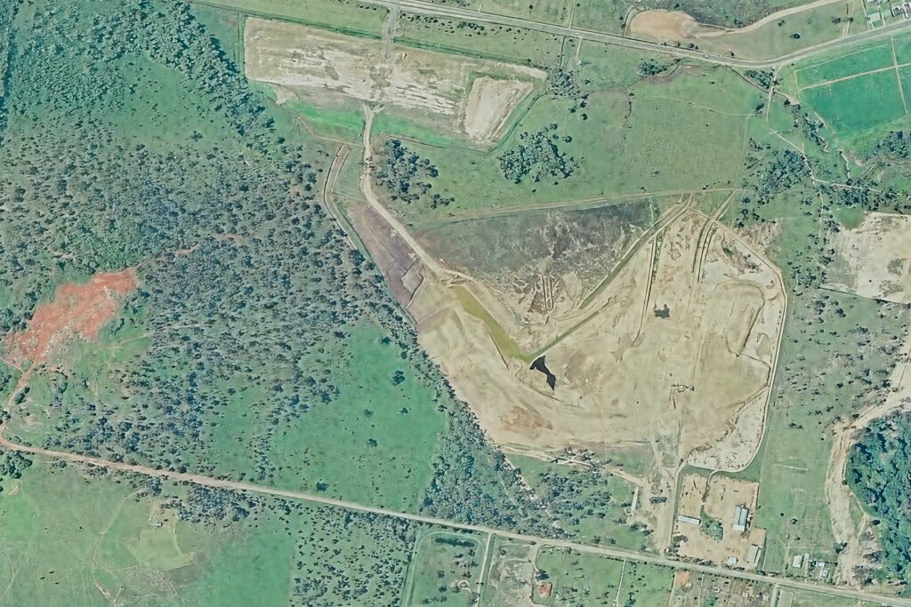
The Curlew Street tip in Sandgate had reached capacity by 1981 and was scheduled to close. In preparation for this closure, Brisbane City Council’s purchase of land between Telegraph Road and the unmade Roghan Road for use as a refuse tip was approved in November 1979. On 14 January 1980 46.3535 hectares were acquired for this purpose. Council sought Town Planning permission from the state government to rezone the land for disposal of household refuse (only dry waste products, not liquid or noxious substances). This required widening of Telegraph Road, additional drainage works and tree plantings, and building a barrier between the tip and the road. A chain wire fence was also erected on each side of the entrance.
A considerable amount of preparation was required for the Telegraph Road site – beautification of the frontage with trees, recovery of top soil and construction of perimeter to hide the tip face and to stop papers blowing about.
Construction of site fencing, provision of water and power services and drainage works were also necessary.
Alderman [Ken] Leese had received assurances that, on completion of tipping operations, the area would be top-dressed, turfed and developed as a recreational area. … After three years, it was planned that the entrance would be changed to Roghan Road (Sandgate and District Historical Society and Museum 2001: 76).
Even before the tip opened, people started dumping rubbish there, despite being liable to prosecution and a hefty fine. In February 1980 Council had to spend over $2,000 to send in a clean-up crew and equipment to restore the area and erect “No dumping” signs.1
The tip shown at the top of the photo above opened on 1 December 1981 and was in operation until 14 January 1985.
- “Dumpers Premature.” The Echo, 27 February 1980: 10. ↩︎
“After the Telegraph Road site closed, the tip was moved south to Roghan Road, behind where Hidden World Playground now stands. An unsealed section of Roghan Road first had to be widened and sealed. From 15 January 1985 this new site accepted residential, commercial and industrial waste from 6.30 a.m. to 6 p.m.”1 It was expected that “About 150 commercial and industrial trucks, as well as household traffic, will use the tip each day. … Burning-off would be prohibited. … Ald Atkinson said commercial use of the Roghan Road tip would begin about August [1987] and was expected to continue for at least two years, before being developed into extensive sports and recreation fields.”2
As it turned out, the tip stopped receiving hardfill in March 2000 (13 years), remediation was completed in 2002 (15 years) and a suggestion that sports facilities would be built in 2005 was never realised.
As part of the landfill’s rehabilitation, a system of pipes and wells was installed beneath the clay capping to extract gases produced by the decaying waste. A proposal was made to see the gas captured, converted and used as an energy source. It was expected that there would be 10-15 years’ supply of power going to the grid from the site.
Under the gas-for-power initiative, gas was used “to provide a clean and green source of energy, reduce odours and help prevent methane from escaping into the atmosphere”.3 The Council started generating 2 MW electricity from the old landfill’s methane. Liberal Lord Mayor Campbell Newman officially opened the plant on 8 September 2004, saying it was expected to last for twenty years, depending on how much gas was produced.4 In 2018 LGI installed a biogas flare and gas extraction infrastructure at this site. The gas has been burnt in a ‘flare’ since then.”5

After the closing of the Roghan Road site, rubbish including old tires, car bodies and old refrigerators was illegally dumped in the bushland at the end of Roghan Road, which at that time finished around Odense Street. As a result, this site was one of the focal points of the Clean Up Australia Day campaign in 2001. Less than a year later, it was again strewn with rubbish. Today a sign remains near the western boundary of the former landfill site on Roghan Road warning transgressors of a potential $13000 fine for illegal dumping.


Formerly part of the Roghan Road landfill site, this location is now home to the Hidden World Playground, which hides a secret for those who dare to explore.
What some visitors to Hidden World might not realise is that its name is based on a fictional but fitting narrative about a group of year nine students who in 1989 purportedly discovered the rotting remains of a giant creature next to a sinkhole at a waste management facility. The story goes that workers subsequently found other corpses of rotting creatures, and scientists were sent to investigate the sinkholes and the possibility of uncatalogued animals.
This supposedly led to the discovery in 1995 of a system of underground tunnels leading to a large cavern where new kinds of fauna and flora had evolved. The waste station on top of the cavern had leached contaminants that caused the creatures to mutate from insect-sized to elephant-sized. The fauna and flora had evolved to breathe methane but could not survive the outside atmosphere. The narrative concludes with the area being capped off in 2005 to preserve this “hidden world” for future generations.1
The real-life play area designed by Russell Anderson is purportedly based on the discoveries in this hidden world, including life-size representations of some of the “methane monsters”, particularly the sand worm that was the original discovery.2 To discover the ending to this story, visitors must solve a puzzle.
In the rotunda a plaque carries the code that can be unscrambled to read this fictional story, and the matching symbols are found throughout the playground.
- https://www.artplusdesign.com.au/hidden-world-stage-2-3/ (accessed 17 October 2022). ↩︎
- Lucy Brook. “Great outdoors.”Brisbane News, 18 January 2012: 12. ↩︎
From the original Fitzgibbon Chase website:
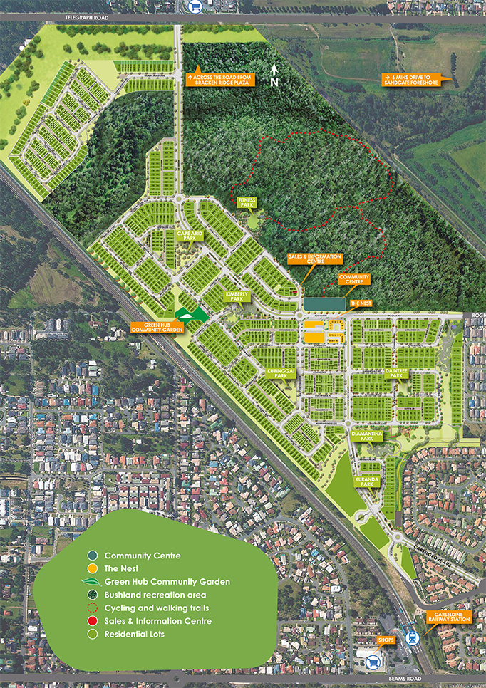
Commenced in 2009, Fitzgibbon Chase is located just 13km from the Brisbane CBD and minutes from public transport, shopping and a range of established amenities. Once complete, the community will comprise of approximately 1,350 homes.
Fitzgibbon Chase has been designed as a vibrant, inclusive community, providing our residents with a diverse range of high-quality, smartly designed and well-priced homes and living options. Land-only sales are also available for the flexibility to utilise a builder of your choice.
Set amidst natural bushland on a 122 hectare site, Fitzgibbon Chase offers an idyllic lifestyle with all homes situated within metres of a park to suit a variety of Residents including first home buyers, professional couples and established families.


Cabbage Tree Creek borders Fitzgibbon on two sides. The main branch of Cabbage Tree Creek/Tighgum is Fitzgibbon’s eastern boundary. The Carseldine Channel runs along the northern boundary and merges with the main branch of Cabbage Tree Creek between the Sandgate Hawks football fields and the Bill Brown Reserve. Fitzgibbon Tributary runs across the suburb and joins Cabbage Tree Creek behind the Somerset Equestrian Centre.
Along its main branch there is a track extending from Cambridge Crescent near Harvard Court. This track follows the creek to exit near the Somerset Equestrian Centre at Iris Place Park. It is an exceptionally pleasant part of Fitzgibbon.
While typically a gentle stream, the creek floods regularly. On 28 February 2022 police reported “A man has died in floodwaters at Fitzgibbon yesterday afternoon. Around 4.15pm the man came into trouble crossing Cabbage Tree Creek Road on foot.”1 Normally a placid stream, it will break its banks in times of heavy rain, leading to local flooding.
There are walking tracks along the length of the main branch at Fitzgibbon, and the Cabbage Tree Creek bikeway extends 16km upstream to where it commences at Arana Hills, as well as downstream to Shorncliffe.
- Man dies in floodwaters Fitzgibbon, myPolice Brisbane Central, 28 February, 2022. ↩︎
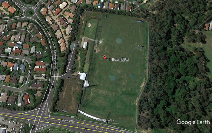
On 4 November 1999 the rights and interests in the site of the former remote receiving station at 441 Beams Road were transferred to the State of Queensland, and the land was then transferred to Michael Gerard Pelling on the same day. Pelling was an entrepreneurial jockey who paid $88,000 for the site. In 2002 he applied to Council to develop it into a $1 million golf driving range and recreation centre, with a water park, skateboard facilities and possibly a women’s fitness centre. The proposal included a sixty-metre-wide conservation zone along the length of the creek.1
The first stage of building, which commenced in 2004, included a car park, a temporary building, lighting and netting. A fence was to be erected to minimise car park noise. In late 2006 Pelling, who had retired as a jockey the previous year after a race fall at Doomben, opened The Big Easy Golf and Leisure Centre. This day/night centre provided twenty-two “Covered Bays, a massive Grass Tree area, Sand Bunker, Chipping Green and a challenging Putting Green all fully lit.”2
In 2009 Pelling installed a novelty target to make the driving experience more enjoyable. When a golfer hit the interactive target on top of a model bus, “Dame Edna Average” popped up and yelled “Hello, possums.” On 22 December 2009 this five-tonne bus was flipped over during gale-force winds and three 1.5-tonne pipes were dragged more than sixty metres, resulting in over $10,000 in damages.3 4
- “‘Teeing off’ for Beams Rd golf range approval.” Bayside Star, 3 July 2002: 2. ↩︎
- https://www.golf.org.au/big-easy-golf/ (accessed 18 October 2022). ↩︎
- “Mostly fine for Christmas Day but more storms at the weekend.” The Courier-Mail, 24 December 2009: 3. ↩︎
- Wakabayashi 2025:181-182 ↩︎

The Holy Spirit College is the first Catholic secondary coeducational school in the area. It sits on the site of the former Big Easy Golf and Leisure Centre, previously the Remote Receiving Station.
The College emphasises Catholic Identity and strives to provide high-quality education through partnerships with other organisations to deliver unique learning opportunities in arts, science, digital technology, sport and foreign languages.
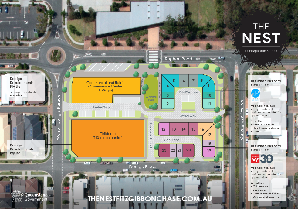
The Nest precinct opposite the Community Centre comprises a 1179m² commercial and retail neighbourhood convenience centre featuring an anchor convenience tenant and a number of specialty retail shops. It includes a childcare centre and 22 freehold properties ideally suited to small and emerging businesses. It offers two-level combined business and residential space. Urban Pure and Villa World were the two developers of The Nest HQ Urban Business Residences.
According to the developers:
The Nest HQ Urban Business Residences are a freehold title and offer 2-storey combined business and residential opportunities.
The property design incorporates a downstairs floorplan which offers a dedicated work space or retail area with street frontage, while upstairs you can choose from either a one-bedroom studio or a two-bedroom open-plan residential design.
The Nest HQ Urban Business Residences are ideally located to take advantage of the 1300-home Fitzgibbon Chase community directly opposite the Fitzgibbon Chase Community Centre which plays host to a range of community activities from dance classes to playgroups to private functions.
The Nest is the vibrant heart of the Fitzgibbon Chase community – a place for people to meet, dine and shop.
The Bill Brown Sports Reserve is named for William “Bill” Brown OAM (1912-2008), an Australian Test cricketer, member of “The Invincibles”, and respected sports figure who owned a popular sports store in Brisbane and served cricket as a player, selector and administrator. Brown was a celebrated Queenslander, honoured for his significant contributions to cricket.
The Bill Brown Sports Reserve covers the area that was formerly the Telegraph Road and Roghan Road landfill and the former Sanitary Depot. The Reserve contains the BMX track, Emily Seebohm Aquatic Centre, Warra Animal Rehoming Centre, netball courts, dog off-leash area, the Hidden World Playground and a second dog off-leash area at Hidden World.
The western part of this reserve adjacent to Telegraph Road has been proposed for a future metro transport depot.

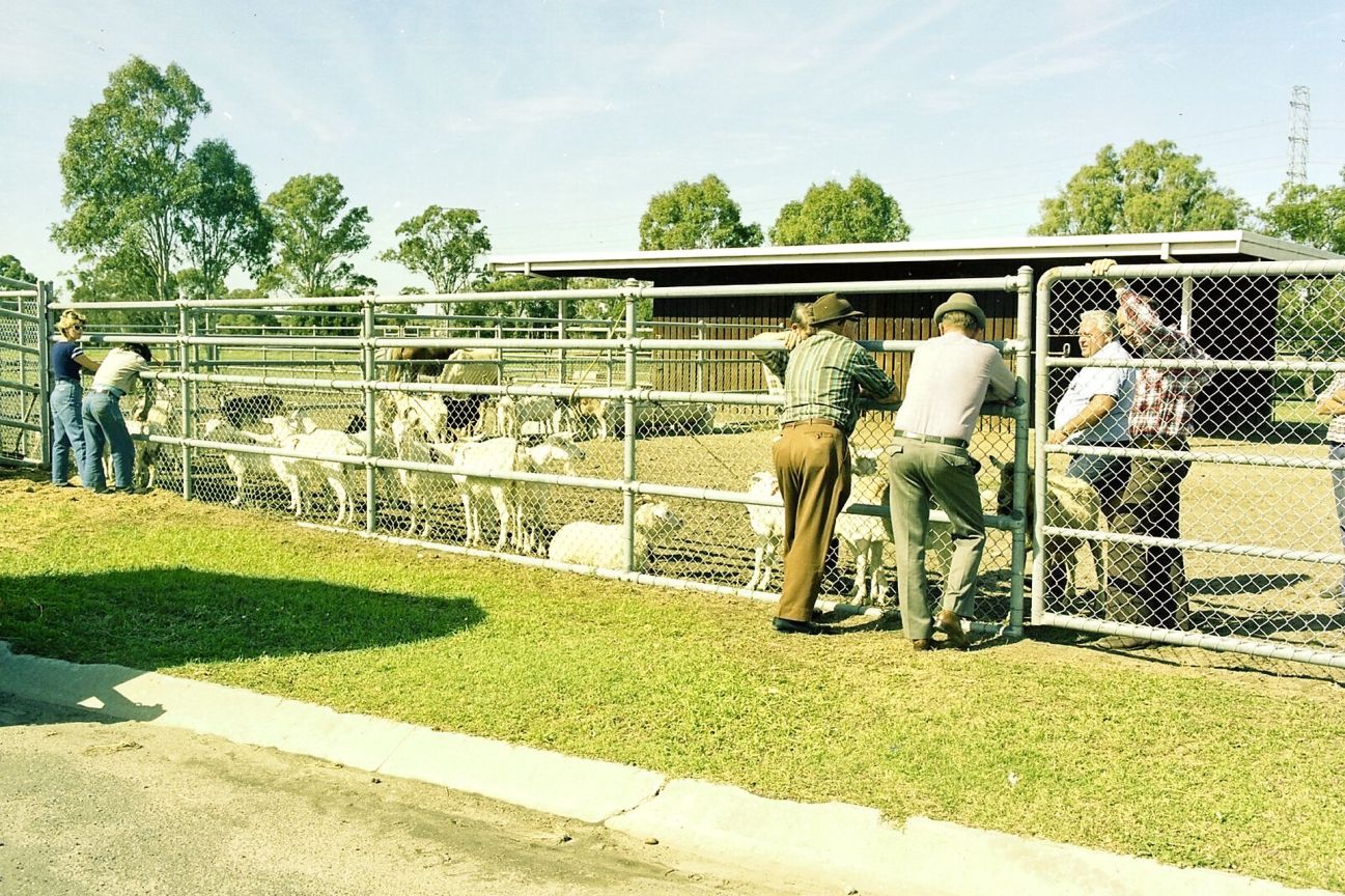
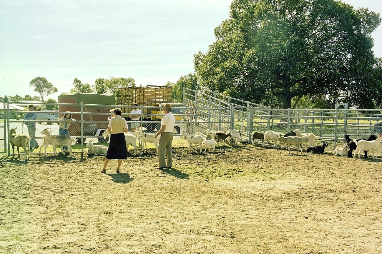
In late 1985 approval was given for the Sandgate Hack and Pony Club to use a 12.63-hectare piece of Council-owned land between the pound and the old tip. Overgrown with weeds, this block was already designated “Sport and Recreation”, and the Club was responsible for making it suitable for use. It needed to be fenced before the move was made.
Council announced in November 2018 that the Club would have to move the following year to make way for a netball precinct. The initial plan was for Council to help it relocate to a purpose-built site west of Hidden World, on the site of the landfill. In April 2019, however, Council gave the club six weeks to vacate their home since 1985. The proposal for the Roghan Road site was abandoned, as it would have cost about $2.7 million for site remediation. No suitable alternatives were available at this time.
By the May deadline the Club had moved a few horses and much of the gear to Redcliffe Pony Club, which gave it permission to hold events, clinics and musters there. Most of the horses found private agistment. In August the Council offered the Club a new home within the Bill Brown Sports Reserve but said the Club would have to wait at least two years before moving in. Because a suitable site could not be found quickly, the Club closed completely. Its assets and funds were donated to Redcliffe Pony Club Inc.1
- Wakabayashi 2025: 190-192 ↩︎

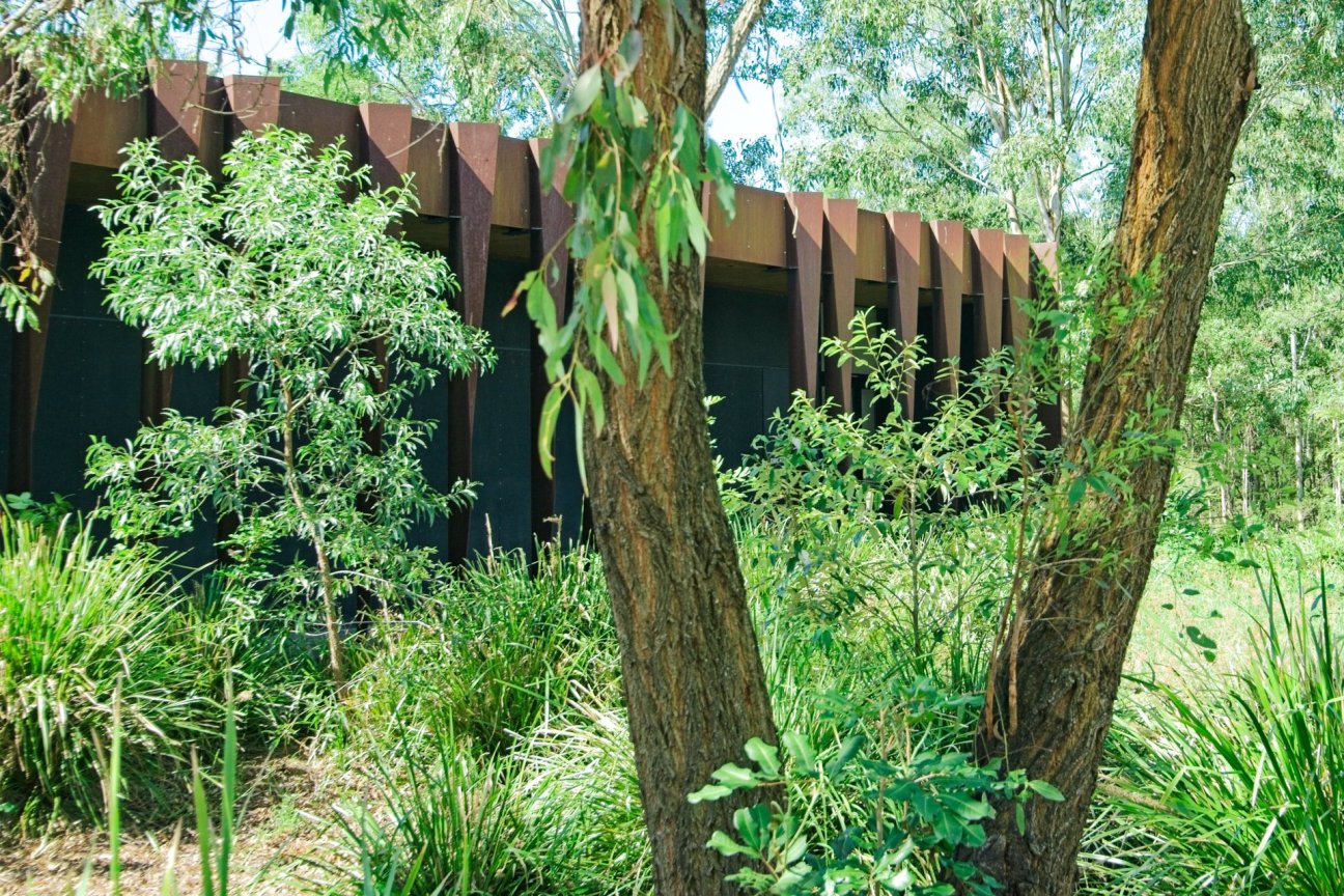
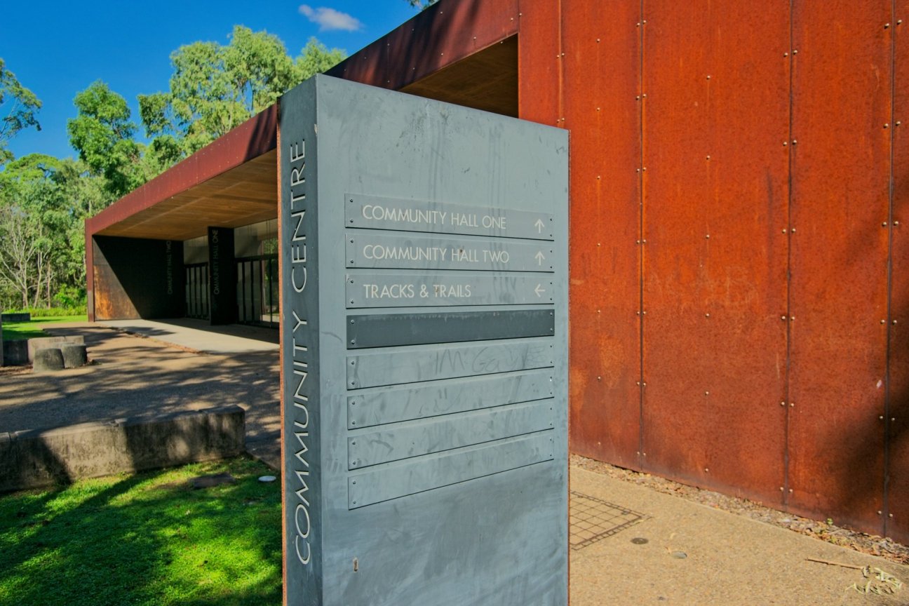
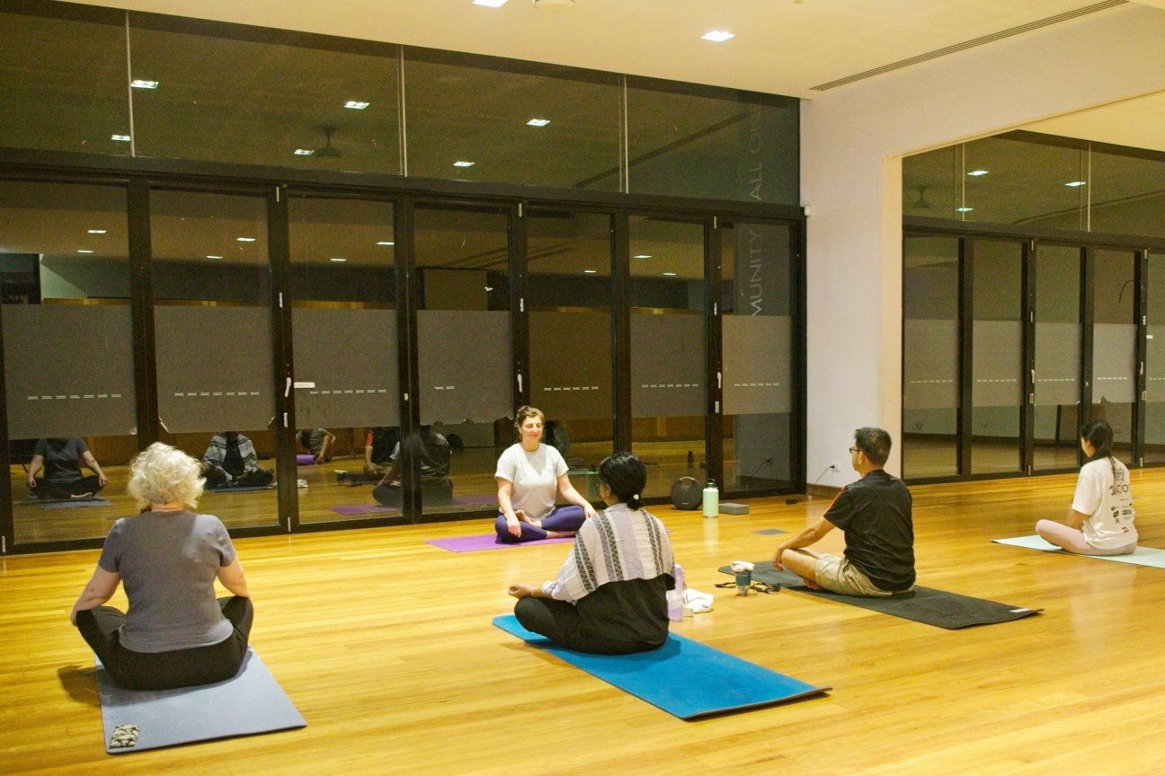
Our award-winning multi-purpose venue sits quietly in its bushland setting and has spaces of different sizes that can accommodate a range of activities and community events. Just 100 metres from the main road through the concourse puts you onto bush tracks and in touch with the local wildlife and traditional heritage. It’s a remarkable transformation and one of the reasons this space has earned its special place in the community.
The Centre was built in 2010 to provide thoughtful, useful spaces for community and cultural activities. The designers KIRK noted:
While formally abstract and demure the Centre makes provocative use of materials, which highlight it as a future landmark in the community. The building is fringed by sculptural blades of weathering steel, a material that responds to the corroded car bodies once found on site. These blades form a rippled screen to the street which reveals glimpses through the building when approached by vehicle.1


Today the location of the Fitzgibbon Community Garden, in the past this was the location of one of the rail crossing gatekeepers’ huts. The rail crossing connected Norris and Dorville Roads.
An original part of the Fitzgibbon Chase development, the Community Garden, known then as the Green Hub, offers a great place for residents to connect, learn, share ideas, and of course, to garden. The Green Hub was gifted to the community by Economic Development Queensland for the purpose of enhancing the local environment and nurturing a community garden.
More than two and a half years of planning and preparation went in to the development of the Green Hub, and the first crops were planted in August 2013.
Community Garden images courtesy Fran Ross.


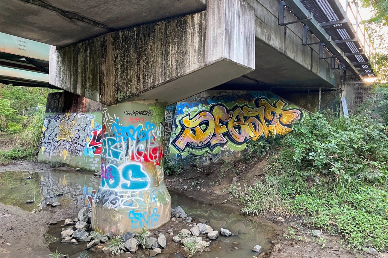
The “Tuned Handrails” can be found on the Carselgrove Avenue bridge, with another two in the adjacent park. These playful railings, the result of a grant from the art+place Queensland public art fund in 2010, are the work of Barbara Penrose, Nameer Davis and one other artist. “The work is titled Night Music and is made of free-bar aluminium tuning forks cut at different lengths to make different musical notes.” 1
- Francene Ridley. “Creative union.” Brisbane News, 29 September 2010: 11. ↩︎


Carseldine Channel is approximately 5.5 km in length and joins Cabbage Tree Creek approximately 5.5 km upstream of the catchment outlet at Shorncliffe. The Carseldine Channel has two streams. One originates on Ridley Road, runs under the railway lines, across Norris Road, continues behind the old Telegraph Road landfill, where it joins the second stream which runs on the other side of the old Telegraph Road landfill. The merged stream joins the main branch of Cabbage Tree Creek behind the Sandgate Hawks football fields.


The long and narrow Iris Place Park that transects the main residential part of Fitzgibbon has existed since around 1997, and stormwater management is integrated into this space.


The Fitzgibbon Chase project is recognised internationally as a new model for hybrid centralised/decentralised water supply systems. Bligh Tanner has created an innovative new water management model for the 114-hectare housing community in Brisbane that allows its water supply to grow as its population increases.
Fitzgibbon Chase features a non-potable stormwater harvesting system (FiSH) and potable roofwater harvesting system (PotaRoo). FiSH diverts, filters and disinfects urban stormwater runoff to supply non-potable water that is suitable for irrigation, toilet flushing, laundry and outdoor uses. PotaRoo harvests roofwater from approximately 500 homes in Fitzgibbon Chase, which is pumped to a central water treatment plant to produce water of potable quality. When operating, FiSH and PotaRoo are estimated to achieve a 60% savings on normal mains water use.
Both plants were successfully commissioned in 2013-14, but they have not been used for their intended purpose due to a range of factors including the relative abundance of water in South East Queensland and governance/ownership issues.
In 2020, Bligh Tanner was engaged by the asset owner to lead the recommissioning and 12-month operation of the FiSH and PotaRoo schemes, to demonstrate their value, and to assist with finding a long-term owner/operator for the schemes.
The Fitzgibbon suburb boundary extends to where the railway line crosses Cabbage Tree Creek. In the pocket bound by Beams Road in this southernmost corner of Fitzgibbon sits Golden Downs, a retirement living community.
In 1992 Golden Downs, an over-fifties community of 231 homes south of Beams Road and close to Carseldine Station, became the first purpose-built relocatable home park approved by Brisbane City Council. Keith Beavis and Carl Benedict Bartels owned retirement homes under the Golden Downs business name. Since June 2009 the land lease operator Serenitas Communities AB Pty Ltd, which develops and operates lifestyle communities for people over fifty years old, has been the trustee.


Fitzgibbon Tributary runs right across Fitzgibbon from the railway line to join the main branch of Cabbage Tree Creek behind the Somerset Equestrian Centre. Normally a gentle stream at the bottom of a steep gully, it carries a lot of water during heavy rain.